
Routeburn Track
Great Walk, multi-night
The Routeburn Track is one of DOC's Great Walks. DOC's track data has it in 5 sections, mostly multi-night. The usual start, Routeburn Track – Flats/Falls Junction – Falls Hut, is 19 km northwest of Glenorchy (straight line). 3 DOC huts and 2 Great Walk campsites are on or near the track.
Huts & Tracks NZ for iPhone. Every Great Walk section, hut and campsite, with offline topo maps and elevation profiles.
Book huts and campsites in advance.
Most Great Walks need booking from late October to April, and some, like the Heaphy, all year. Bookings open months ahead and popular dates sell out. Great Walks on doc.govt.nz
Sections
- Flats/Falls Junction – Falls Hut2.4 km, multi-night
- Falls to Harris Saddle3.4 km, multi-night
- Lake Mackenzie Hut to Harris Saddle6.9 km, multi-night
- Howden Shelter to Lake Mackenzie Hut7.9 km, over 4 hours
- The Divide to Lake Howden3.2 km, 1-4 hours
In walking order from the usual start, found by joining the ends of DOC's sections. DOC's data doesn't give the length of the whole walk; see DOC's page for it.
Huts along the walk
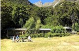 Routeburn Flats HutGreat Walk, 20 bunks300 m
 Routeburn Falls HutGreat Walk, 48 bunks10 m
 Lake Mackenzie HutGreat Walk, 57 bunks30 m
Every Great Walk hut, with bunks
DOC huts within 500 m of the sections, in walking order. Bunks as DOC lists them.
Campsites on the track
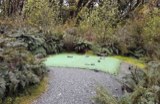 Lake Mackenzie CampsiteGreat Walk, fee, book ahead, no car access460 m
 Routeburn Flats CampsiteGreat Walk, fee, book ahead, no car access540 m
DOC campsites within 1 km of the track.
Getting to the start
Directions in Apple MapsGoogle Maps
Coordinates of the usual start: -44.72560, 168.21909. Many Great Walks are one way, so plan transport at both ends.
Other Great Walks


Campsites and facilities near Glenorchy
Track, hut and campsite data from DOC, 14 Nov 2026. Check DOC alerts before you go.